History of the Oulu City Centre’s Development
The Oulu city centre has been developed systematically for centuries. The first detailed city plan was compiled over 370 years ago, and over the years, many different plans have been created to ensure the functionality of the city area.
Until the 1950s, the city has been zoned due to fires and wars as the city centre had to be rebuilt after destruction. After the wars, the city began to grow rapidly, and the land use planning extended outside of the city centre.
Today, the city centre development is directed by the Oulu City Centre Vision.
History
1651 – Oulu’s first detailed plan
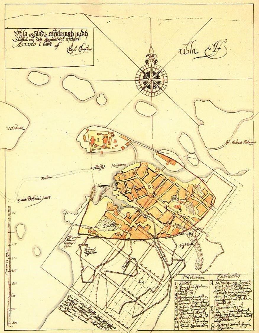
The Oulu urban area’s first regulariteetti, i.e. urban plan and street reorganization, was created by the Swedish land surveyor Claes Claesson in the years 1649–1651. He received a royal order for this work. He worked based on a plan created by Pietari Brahe.
The detailed plan created in 1651 was quite radical for its time. It followed the urban ideals of the renaissance and did not consider the existing city structures or land. It placed a rectangular grid directly onto the existing city structure. The primary goal of the detailed plan was to build a city with square blocks and a regular street network.
In the plan, the city area extended to the south and almost doubled in size. The planned area consisted of three parallel block rows and extended 475 x 813 meters.
However, citizens heavily opposed the plan since it included moving almost every block and building. It was easier to implement the plan after the 1652 fire which destroyed a lot of property owned by the middle-classes. Rebuilding the city according to the idealized plan was easier after the destruction.
1825 – Detailed plan of Oulu
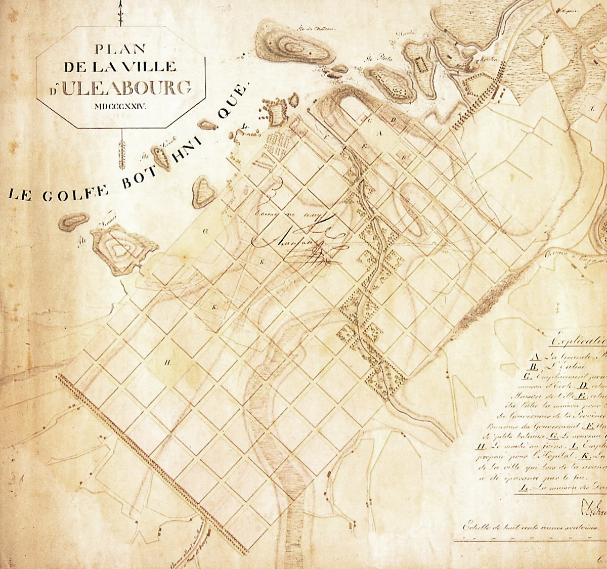
Oulu faced its worst fire in 1822. The fire was so destructive that all citizens of Oulu were released from taxes for 10 years and financial support for rebuilding the city was collected from the entire country.
A committee was established to plan the city’s rebuilding after the fire. The rebuilding plan was based on the regular grid plan, and it was planned by the Councilor of State Johan Albrecht Ehrenström, who designed the Helsinki detailed plan in 1816, and the German architect Carl Ludvig Engel, who was invited from St. Petersburg to help design Helsinki and the Senaatintori Park and its buildings.
The 1825 plan’s goal was to promote fire safety, protect the city from possible flooding and increase the city’s beauty. Blocks were enlarged and streets were widened for fire safety, and buildings were limited to one floor. The plan included Claesson’s grid concept.
A pedestrian park was built between the city ditch, and a large marketplace was built around the church. Puistokatu became the city’s southern border.
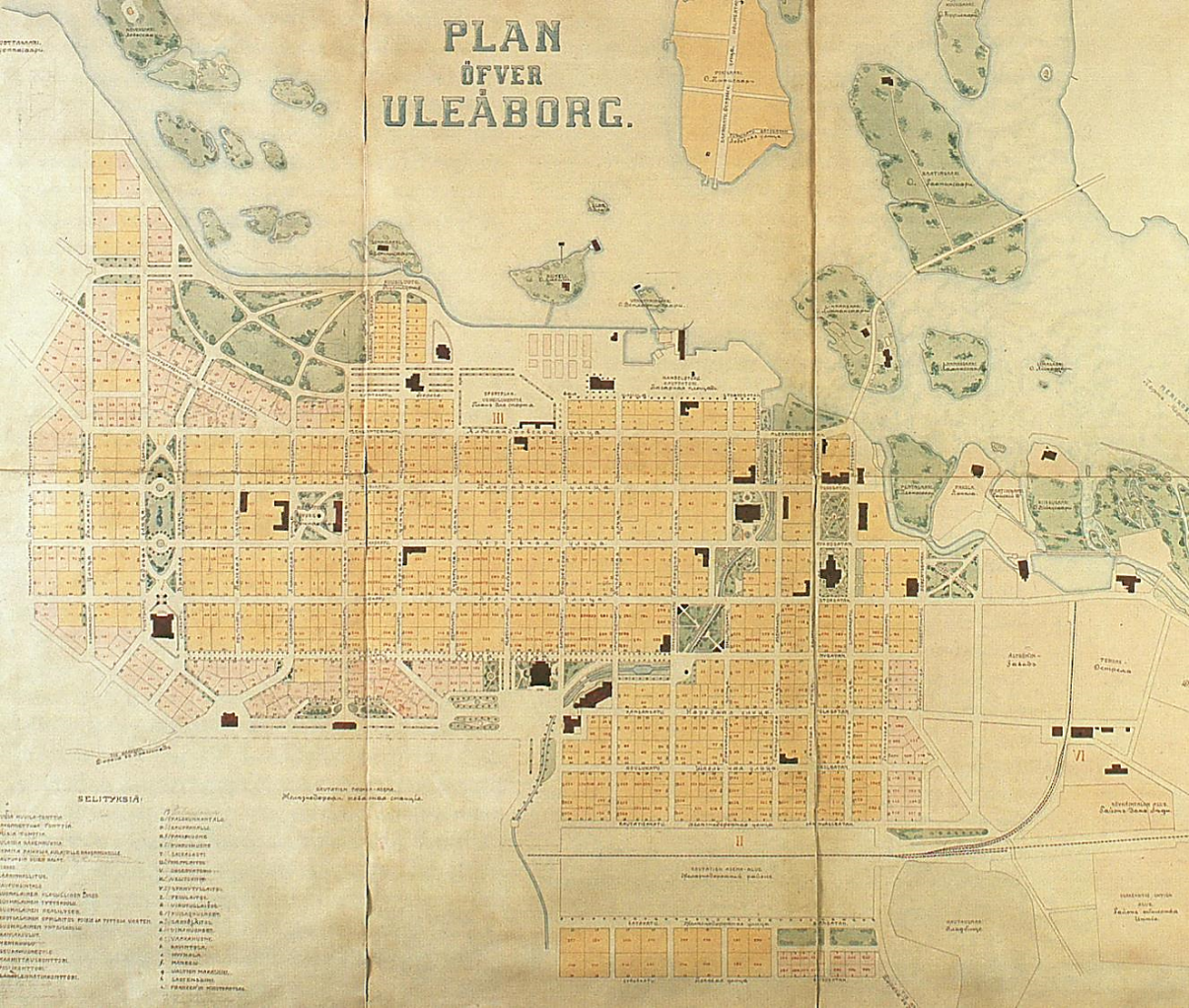
1908 – Detailed plan of Oulu
After the previous detailed plan, the railway arrived in Oulu and was introduced in 1886. The railway brought economic and cultural development for the entire area with it.
The city centre expanded behind the railway and southwest where a new four-block long park area was built, what is now known as Kyösti Kallion puisto. A large beach park was planned for Hollihaka which was surrounded by blocks in a curve.
The 1908 plan included multiple open layouts and public buildings that served as the urban structure’s highlights and street scene’s climaxes. The plan also introduced street numbering based on street name.
The plan was designed by City Engineer Alexander Brandt and Architect Victor J. Sucksdorff among others. The Plan Designer was Architect Bertel Jung.
1947 – Alteration to central parts of the detailed plan
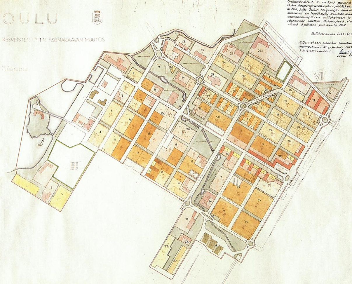
The Oulu city centre was heavily damaged by bombing in the second world war and the city was filled with destroyed buildings.
In 1947, an alteration to Oulu’s detailed plan’s central areas was approved. The alteration was compiled by Architects Otto-Iivari Meurman and Aarne Ervi. The goal was to create a functional and artistically valuable city centre as well as to rebuild the block destroyed during the war.
The plan defined the business blocks of the city centre, Kirkkokatu and Hallituskatu for the first time. The business blocks received more building rights than housing blocks.
Traffic structures were renewed and some of the streets were proposed to be altered into park-like pedestrian streets.
Hallituskatu served as the primary axle, by the end of which stood the travel centre.
The new centre square, the current Rotuaari Square, was placed in the corner of Kirkkokatu and Pakkahuoneenkatu.
2001 – City Centre Traffic and Land Use Plan
The goal of the City Centre Land Use and Traffic Operational Plan 2020 (Keskustan maakäytön ja liikenteen tavoitesuunnitelma; MALI) was to define the city centre’s development goals until the year 2020.
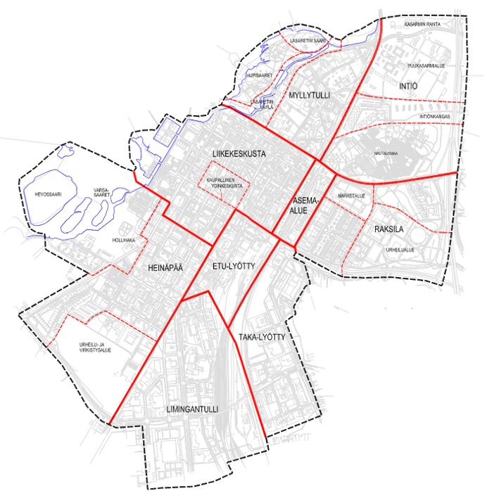
The planning area consisted of the business centre, station area, Raksila, Myllytulli, Hupisaari Islands, Intiö, Heinäpää, Hollihaka, Etu-Lyötty, Taka-Lyötty, and Limingantulli.
In the 2001 plan, the city centre consisted of six main blocks.
Different public transport and traffic options were considered and the development of Torikatu into a public transport street began.
To develop the city centre and the main blocks and to solve parking, the plan proposed the construction of a centralized, underground parking facility.
2010 – Lively city centre
The goal of the 2010 plan was to compare the differences between a centralized parking facility and scattered parking solutions.
In the plan, an experiential development main area was defined from Raksila to the Marketplace via the city centre. The area was called “the thread of life”.
The plan enabled the implementation of the Kivisydän Parking Facility and Shopping Centre Valkea.
2017 – Oulu City Centre Vision 2040
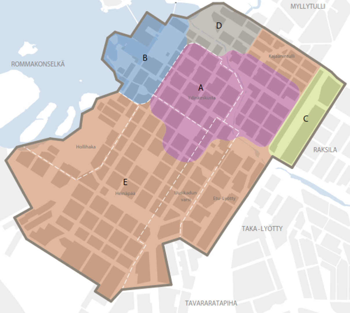
Current development is directed by the Oulu City Centre Vision 2040, compiled in 2017 (in Finnish).
The service centre (A) is the most diverse and dense. The marketplace (B) is a meeting place and centre of events. The station centre (C) connects Raksila and the city centre and is the junction for traffic.
The historical centre (D) includes the Cathedral and Franzeninpuisto Park. The housing centre (E) includes Heinäpää, Hollihaka, Etu-Lyötty, Uusikatu and Kajaanintulli.
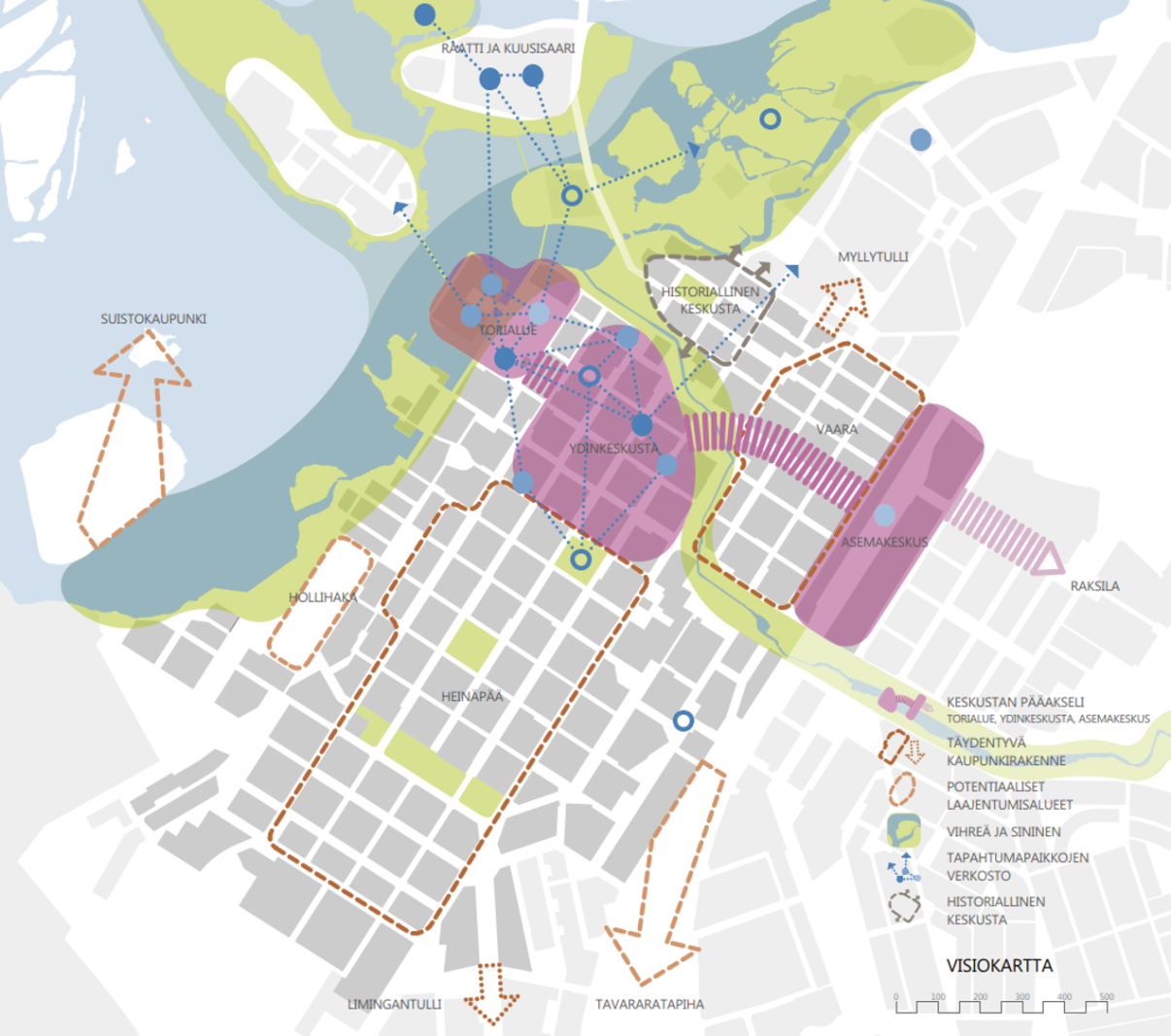
The City Center Vision’s slogan is “Lively and diverse meeting place”.
The vision includes five central development principles that guide urban development in the city centre:
renewable and complete city structure
mobility
green and blue
urban culture and events
economy and learning
2020 – Oulu City Centre Vision’s monitoring

The City Centre Vision has affected especially housing construction, cycling conditions and park renewal. Significant actions are the infill development in Heinäpää, River Delta City Vision (in Finnish) and Parking Programme 2040 (in Finnish).
The focus areas of the Oulu City Strategy 2030 and the Environmental Programme necessitate the renewal of the City Centre Vision by the end of the Council period 2021–2025.